Drone Land Survey
Elevate your property insights with our Drone Land Survey service, providing comprehensive aerial data for precise mapping and effective land management.
Whether you're overseeing a construction project or seeking to maximise your land's potential, our expert drone survey service delivers the critical information you need, simplifying complex land management tasks.
Our Process
Our service offers an unparalleled perspective of your property, aiding in detailed mapping, strategic planning,
and efficient land management with superior precision and speed.
Initial Enquiry
We engage in a detailed discussion with the client to understand the specific requirements of the project. We explore the location, the objectives, and the timeline, ensuring we grasp every detail.
Following this, we craft a tailored quote, providing the client with the option to proceed based on their preferences and needs.


Shoot Day
On the day of the shoot, our team arrives equipped with cutting-edge drone technology, ready to capture comprehensive footage that covers all pre-discussed aspects.
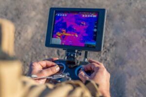
Our drones, operated by skilled professionals, meticulously survey the land, ensuring every inch is documented. This process is not just about capturing footage; it's about gathering a wealth of data that offers a profound understanding of the terrain. The precision of our drones, combined with the expertise of our team, ensures that every relevant detail is recorded, providing a solid foundation for the subsequent analysis and decision-making stages.
Analysis & Evaluation
Post-shoot, our team delves into the data, extracting pivotal insights that align seamlessly with your project's objectives. We compile a detailed report, enriched with actionable information, and present the high-definition video footage from the survey.
This comprehensive analysis empowers our clients, enabling informed decision-making and strategic planning, backed by accurate, data-driven insights.

Land Survey Drone
FlyCamSolutions' Drone Land Survey service is meticulously designed to deliver detailed and precise land analysis. Whether it's for real estate development, agricultural strategising, or environmental assessment, our drones provide extensive data across vast land areas.
This service offers a comprehensive view from above, facilitating mapping, planning, and land management with enhanced accuracy and efficiency.
How we work
Our drone land surveys transcend traditional surveying methods, presenting a more sustainable and eco-friendly alternative. By minimising the need for physical presence in delicate areas, we significantly reduce environmental disruption.
Despite this gentle approach, our service does not compromise on the depth and breadth of data collected. It supports responsible land use and development, ensuring that every decision you make is informed, precise, and considerate of the environment.

Ready to Elevate Your Surveying Experience?
Connect with the experts at Fly Cam Solutions today. Let us provide you with precise, efficient, and safe drone surveying solutions tailored to your needs.
Other Services We Offer
Revolutionising Construction with Thermal Imaging Drones